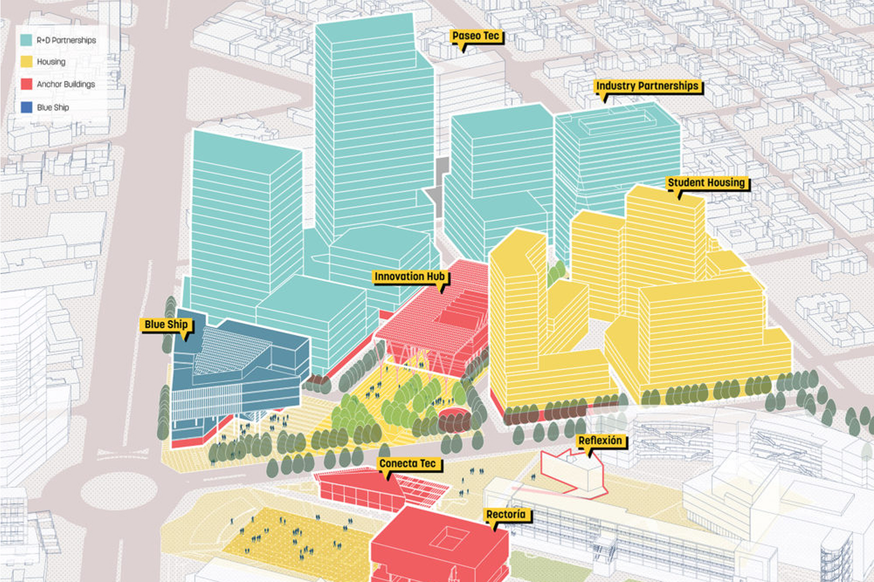
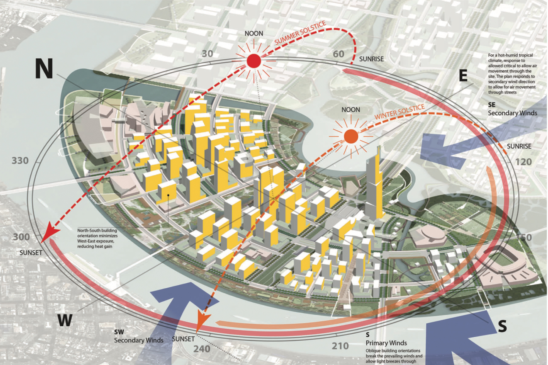
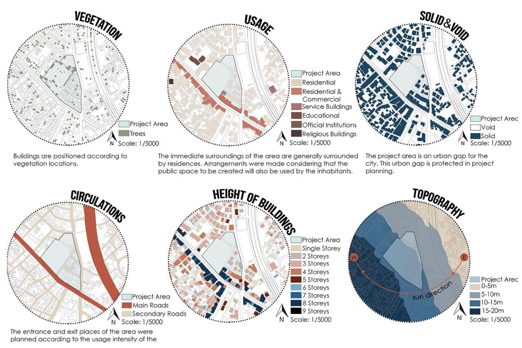
01
Architectural Site Analysis

Read the city
in one click.

Drop a pin anywhere on Earth. EasyMap pulls live urban data and renders publication-grade analysis diagrams.

02D analyses
0+daily users
0sto first board
Scroll
What it is

A site analyst
in your browser.

No GIS software, no manual tracing, no data wrangling. Pick a location and a radius, choose the analyses you need, and EasyMap generates a coordinated set of clean, editorial diagrams.

Capabilities

Eighteen 2D analyses. Plus 3D massing.

01
Roads & Movement
Street hierarchy, flow, walkability and noise zones.
02
Functional Zoning
Land use coloured by function.
03
Green & Water
Parks, forests, rivers and water isolated cleanly.
04
3D City Massing
Extruded volumes by height, zoning or density.
05
Sun & Solar
Sun path, solar exposure and orientation studies.
06
Layered Axonometric
Stack analyses into an exploded axonometric poster.
Max studios

Beyond analysis. Concept to board.

feat-bubble.jpg
Concept Diagram Studio
Organic bubble, flow and zoning diagrams — pick spaces, draw flows, switch palettes, even a hand-drawn sketch mode.
feat-layout.jpg
Portfolio Layout Studio
Professional A3 / A2 / A1 boards — 13 designed layouts, 5 palettes, 6 type pairings, batch image fill.
Plans & Max tools

One price. Yours forever.

PRO
€2.99
one-time · lifetime
✓ All 18 2D analyses
✓ No watermark
✓ Report PDF · Portfolio board · SVG export
✓ Custom accent & themes
MAX
€4.99
everything · one-time
✓ Everything in Pro
✓ Full 3D city massing
✓ Concept diagram studio — bubble / flow / zoning
✓ Portfolio layout studio — A3 / A2 / A1 boards
Free plan: 4 analyses with watermark — try before you buy.
Workflow

Three steps to a finished board.

Locate the site

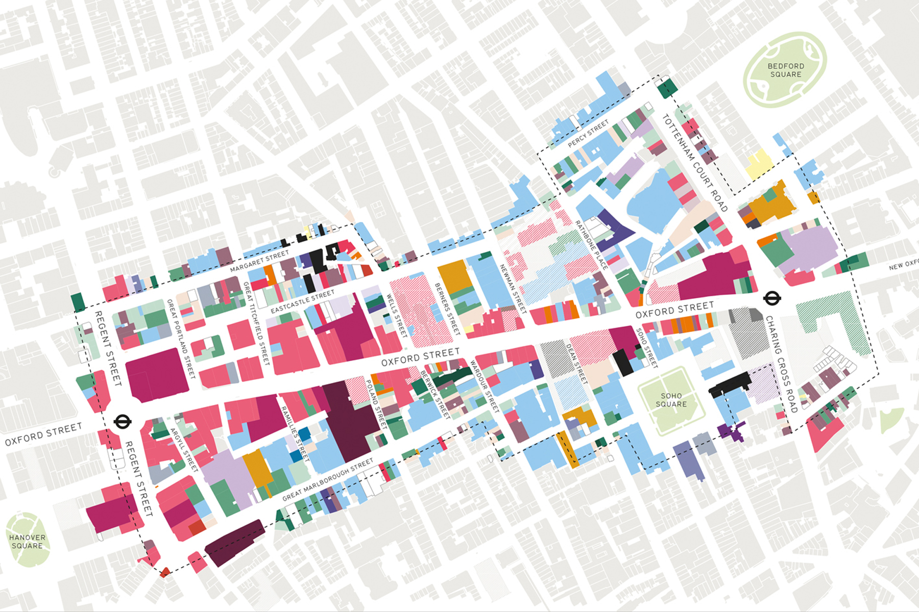
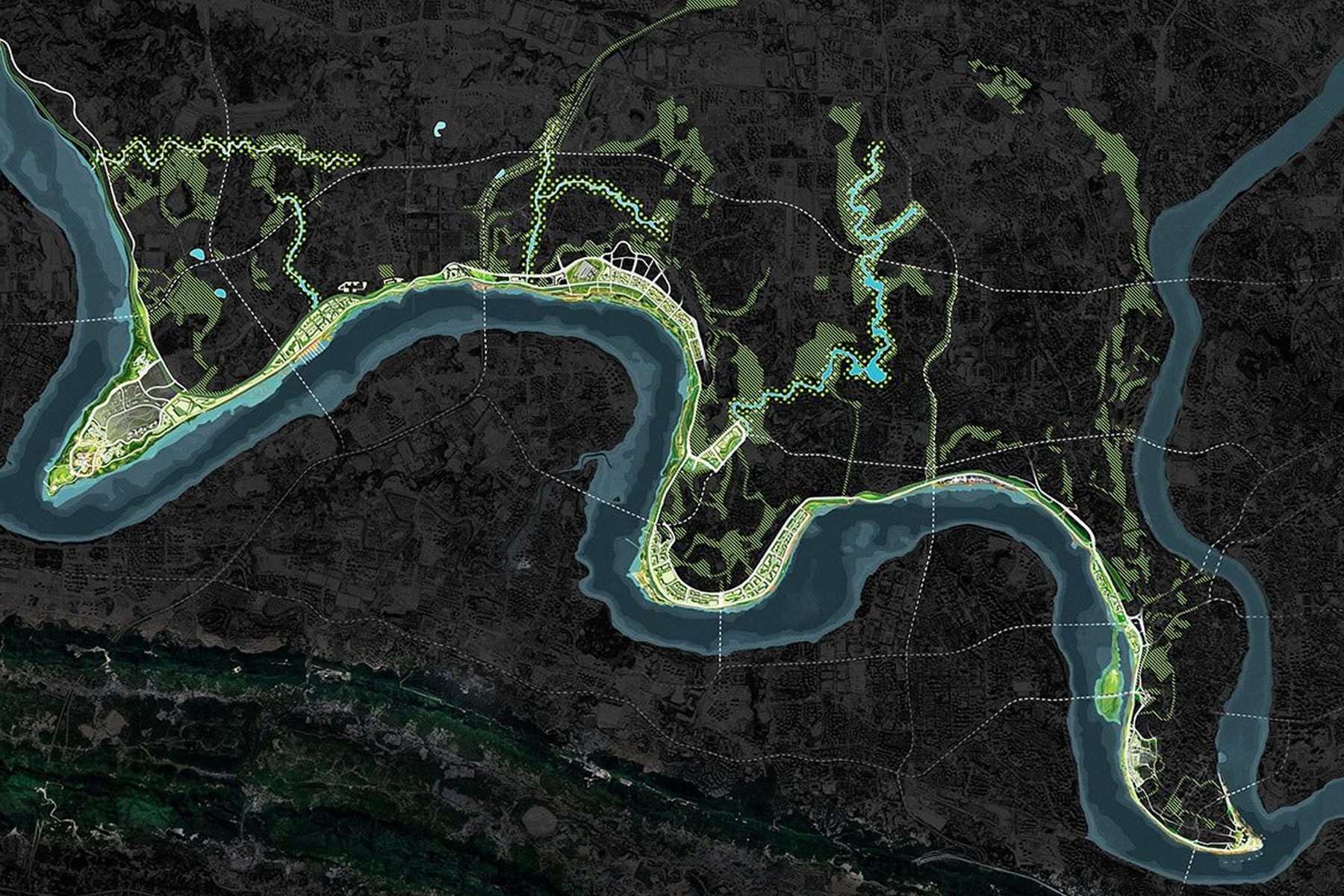
Search an address or click the map. Set a radius from 200 m to 2 km.

Choose analyses

Toggle any of the eighteen 2D diagrams, or switch to 3D massing.

Generate & export

Render instantly, then download a report, poster or axonometric PDF.